Consulting
Paleoglaciology and radioactive waste repositories
My own publications:
Cohen, D., Gillet-Chaulet, F., Haeberli, W., Machguth, H. and Fischer, U. (2018): Numerical reconstructions of the flow and basal conditions of the Rhine glacier, European Central Alps, at the Last Glacial Maximum. The Cryosphere 12, 2515–2544. doi.org/10.5194/tc-12-2515-2018
Haeberli, W., Linsbauer, A., Cochachin, A., Salazar, C. and Fischer, U.H. (2016): On the morphological characteristics of overdeepenings in high-mountain glacier beds. Earth Surface Processes and Landforms 41, 1980-1990. doi:10.1002/esp.3966
Haeberli, W., Fischer, U.H., Cohen, D. and Schnellmann, M. (2020): Radioaktive Abfälle und Eiszeiten in der Schweiz. Wasser, Energie, Luft 112 (4), 261-269.
Jouvet, G., Cohen, D., Russo, E., Buzan, J., Raible, C.C., Haeberli, W., Kamleitner, S., Ivy-Ochs, S., Imhof, M.A., Becker, J.K., Landgraf, A. and Fischer, U.H. (2023): Coupled climate-glacier modelling of the last glaciation in the Alps. Journal of Glaciology 1–15. doi.org/10.1017/jog.2023.74
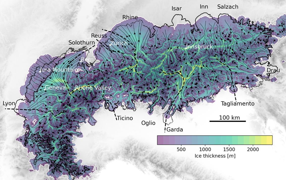
Glacier erosion can carve deep channels and overdeepened structures into bedrock. In the Northern Swiss Alpine Foreland, such erosion occurred repeatedly during past ice ages and, during possible future glaciations, could potentially affect deep geological repositories for high-level radioactive waste.
To assess this long-term geological risk, a comprehensive research program was conducted by Nagra, the Swiss agency responsible for planning radioactive waste repositories. The investigations combined deep drilling, geophysical soundings, and long-term climate-ice model simulations. In addition, an internationally coordinated global compilation of quantitative data on overdeepened geomorphological structures was analyzed to establish the current state of knowledge and to evaluate the predictive potential of comparable analogues.
Results show that erosion by the largest ice age glaciers in the Northen Alpine Foreland locally extended to depths below present-day sea level. Towards former ice margins, linearly concentrated erosion by pressurized water at the base of the glaciers seems to have had a predominant influence. The location and depth of planned repositories must be selected with careful consideration of such deep erosional processes in order to avoid potential impacts during possible future ice ages.
Climate-related safety aspects of hydropower systems
My own publications:
Haeberli, W., Buetler, M., Huggel, C., Lehmann Friedli, Th., Schaub, Y. and Schleiss, A.J. (2016): New lakes in deglaciating high-mountain regions – opportunities and risks. Climatic Change 139(2), 201-214. doi:10.1007/s10584-016-1771-5
Haeberli, W., Huggel, C., García-Hernández, J. y Guillén Ludeña, S. (2016): Proyectos de ingeniería multipropósito incluyendo protección contra crecidas, producción de energía y demanda de agua en las cordilleras peruanas: Principios, potencial y desafíos. Un documento orientador. Con contribuciones de: César Portocarrero, Luis Vicuña, Christine Jurt, Holger Frey, César Gonzáles, Karen Price, Miriam Cerdán, Fernando Valenzuela, Melissa Monzón y Claudia Giráldez. Proyecto Glaciares+, Lima, Peru.
Carte Blanche, Swiss Academy of Sciences:
Kaunertal Pump-storage project:
https://www.wwf.at/wp-content/uploads/2025/03/KaunertalGutachten_WHaeberli-1.pdf
Climate-induced glacier retreat and permafrost degradation are significantly affecting hazards and risks in high mountain regions. Mobile water bodies, both in existing and newly forming lakes, are increasingly located close to steep slopes. These slopes often show reduced stability as a result of glacial de-buttressing and weakening permafrost strength. This combination of processes can lead to cascading failure events, where one hazardous process triggers a sequence of further destructive processes with far-reaching consequences. Recent catastrophic events in the Indian Himalaya, such as Chamoli (2021) and South Lhonak (2023), with severe damage to hydropower infrastructure, clearly illustrate this emerging challenge.
Such climate-induced changes in hazard conditions have not always been adequately considered in existing long-term concessions for hydropower infrastructure in cold, ice-affected mountains. There is therefore a clear need to reassess safety aspects, not only for planned projects but also for existing infrastructure.
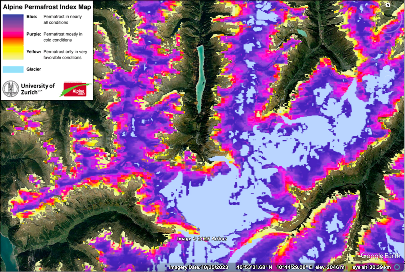
For example, in the catchment of the Gepatsch reservoir in the Austrian Kaunertal, the Alpine Permafrost Index Map provides information on the current distribution of permafrost and glaciers. Similar datasets exist worldwide, including projections of future glacier retreat and potential lake formation. Indicators also exist for failure-susceptible slopes. Complex model chains are available to estimating the reach and impacts of large slope failures that may trigger tsunamis in lakes, leading to flood waves and subsequent debris flows.
This body of scientific knowledge provides an essential basis for assessing hazard potential and developing long-term safety concepts and disaster risk reduction strategies.